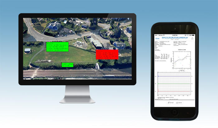
GEO-Instruments has a wide array of monitoring platforms at its disposal to gather and make site data readily available to our clients.

GEO-Instruments uses two main types of data presentation software:
Large scale projects
For large scale projects with a need for comprehensive control over data, such as Crossrail in the UK, GEO-Instruments can mobilise client-based software installed on any PCs necessary.
These link to a database which distributes information continuously with minimal delay via GtcVisual. This software has been developed internally by GEO-Instruments and is used globally.
Its two main benefits are:
- Advanced processing capabilities such as contours plots and deformation calculations.
- Scalability for large projects, allowing GEO-Instruments to display and manage data for several thousand monitoring points on a single project.
Small scale projects
For small scale projects, GEO-Instruments offers QuickView. Hosted in the cloud and accessible by our clients from any Internet-connected machine with just a login and password, QuickView is quick to deploy and easy to use. Within minutes it can be set up, used and co-managed by clients when required.
QuickView was first developed in-house by GEO-Instruments in 2013. It’s a future-orientated and scalable platform, continually updated to introduce more advanced features, such as contour plots, automatic pdf monitoring reports, on-the-fly averaging and processing, site journals, automatic email and SMS alerts, multi-project management, 3D views and many more.
Quickview can fulfil all instrumentation tasks, whilst bringing robust reporting features. These include:
- Multi type sensor display
- Automatic email and SMS alert system
- Automatic pdf reports
- 3D views
- On-the-fly processing
- Raw and processed data export
- Advanced data presentation graphs (contour line plots, inclinometer plots, wind roses, value vs distance spatial plots, 3D construction progress solutions)